
NUSO 2017 Research Missions
Bald Earth Digital Terrain Modeling
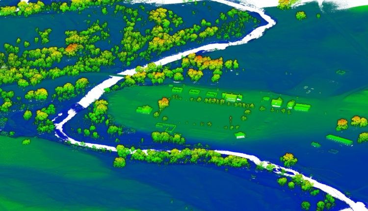
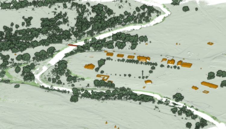
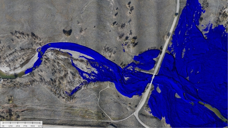
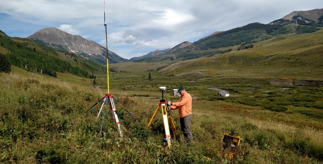
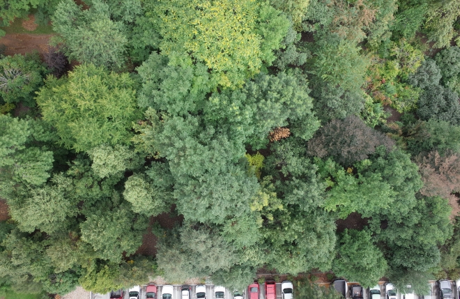
Fort Laramie National Historic Site in Wyoming
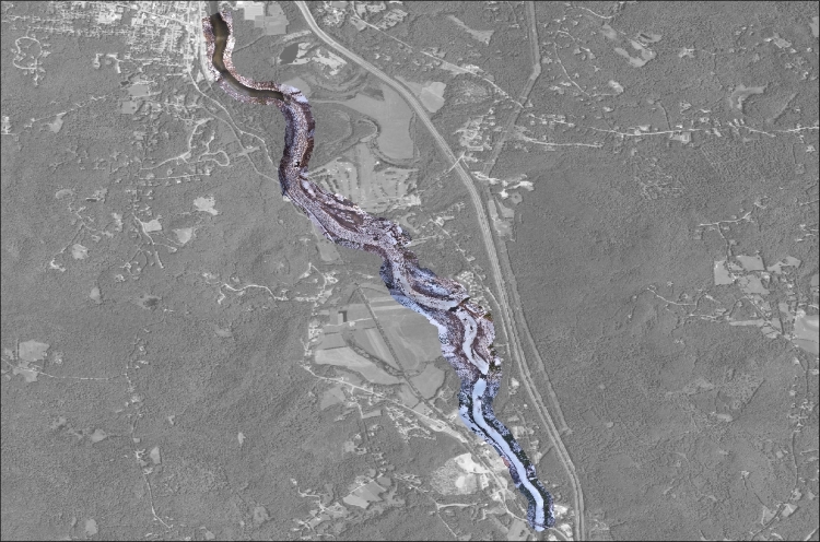
In 2017, the National Park Service approached U.S. Geological Survey’s National Uncrewed Systems Office to acquire geospatial data in support of developing a flood management plan for the Fort Laramie National Historic Site, Fort Laramie, WY. Originally established as a private fur trading fort in 1834, Fort Laramie evolved into the largest military post on the northern plains and eventually became part of the National Park System in 1938. Located at the confluence of the Laramie and North Platte Rivers, the park experienced two consecutive 100-year flood events in 2015, and 2016. Increased damage to the park highlighted a need to implement a flood management plan.
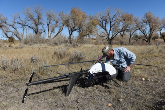
The mission objective was to collect a high-density LiDAR point cloud data to generate a bald earth digital terrain model to be used in additional flood analysis for the park. A quality control check was implemented with a stand-alone survey for research accuracy comparisons.
The two remote pilots collected 24 GB of RAW LiDAR scans and 53 GB of raw imagery over a 3-day period. The average point density of the cloud product was approximately 210 points per square meter. The integrated Yellowscan Surveyor LiDAR payload penetrated areas of thick vegetation to provide ground based returns near the river channel. River channels are especially prone to high vegetation growth and the ability to accurately scan and attribute the LiDAR point cloud, without null data, is necessary to create a bald earth digital terrain model of the surrounding channel. The Yellowscan Surveyor allowed the data collection to be conducted with a two-man crew, which allowed the field crew to focus on flying safely. Aviation Safety is the upmost importance to all DOI’s UAS research activities.
"The LiDAR data collected will be combined with channel cross sections of the Laramie River to create a floodplain map for evaluating the vulnerability of park assets affected by more frequent flooding events. This will better inform NPS management decisions for mitigating flood risks at Fort Laramie National Historic Site." - NPS Natural Resource Manager.
Study Point of Contact:
Nell Conti, Intermountain Region GIS Coordinator
National Park Service
Groundwater Discharge Identification
East River in Gunnison National Forest, Colorado
Sensors mounted on UAS enable collection of environmental data not otherwise available, including documentation of study area conditions (vegetation coverage, stream morphology, visible streambed and streambank features, water temperature, etc.) concurrent with other data collection to inform integrated analysis of hydrologic data for the larger groundwater/surface-water exchange study. This technology also enables more rapid data collection over a larger area than handheld sensors, and therefore may decrease personnel exposure to water safety hazards present during in- or near-water work.
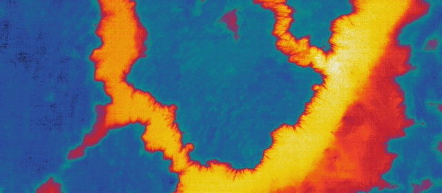
In August of 2017 the USGS Water Mission Area Office of Groundwater Branch of Geophysics, with help from the NUSO, conducted UAS data collection missions over and adjacent to the East River and Redwell Basin stream corridors of the Gunnison National Forest near Crested Butte, Colorado. Natural color imagery was acquired from a Ricoh and thermal infrared was acquired using the FLIR Vue Pro, a 3DR Solo was used to fly each of the sensors. The natural color imagery was used to create a DEM of the East River to detail streambed bathymetry along exposed banks. Thermal data was used to search for temperature anomalies along the banks and waterline that could potentially indicate focused groundwater seepage.
Study Point of Contact:
Cian Dawson, Hydrologist
USGS Branch of Geophysics
cbdawson@usgs.gov
Leaf Off and Leaf On for Vegetation Analysis and Inventory
Colorado State University Arboretum in Fort Collins
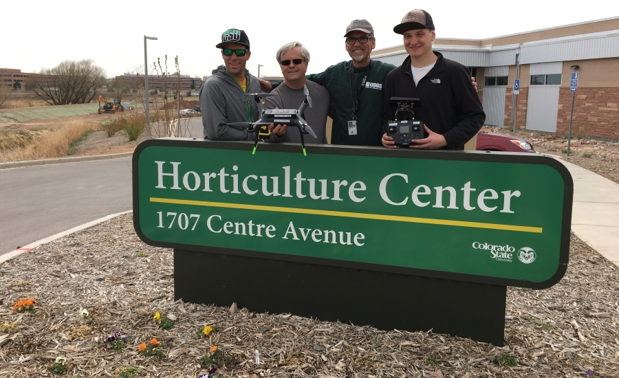
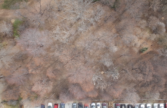
In 2017 NUSO researchers worked in collaboration with the Colorado State University (CSU) College of Agricultural Sciences to evaluate the value of products generated from UAS data collection for vegetation analysis and inventories. Data collection was performed over the Colorado State Arboretum on March 25th to collect leaf off data and on September 16th to collect leaf on. Both missions collected imagery data from both the MicaSense RedEdge 3 and Ricoh GR sensors mounted on 3DR Solos.
The high resolution RGB data collected from the Ricoh and the MicaSense multi-spectral data was processed using the same calibration, ground control, and processes to generate a set of leaf off and leaf on orthomosaics, digital elevations models (DEM), and Normalized Difference Vegetation Index (NDVI). In addition, the RedEdge 3 raw imagery was pre-processed with custom Python code to produce one set of images with “reflectance” values and a second set of images with “radiance” values. These pre-processed images were then used to create two different, five banded, orthomosaics. The complete set of products was provided to CSU faculty to evaluate for use in vegetation analysis and inventory generation activities.
Study Point of Contact:
Chris Holmquist-Johnson, Hydrologist
USGS Fort Collins Science Center
h-johnsonc@usgs.gov
Rapid Response: Flood Monitoring
Pemigewasset River near Plymouth, New Hampshire
The USGS State Liaison and the New Hampshire Department of Environmental Services requested a rapid response UAS mission to acquire low altitude high resolution imagery of flooding caused by an ice dam (jam) occurring in and near the towns of Plymouth and Holderness, New Hampshire. Rapid delivery of this high-resolution data was crucial for the situational awareness and emergency response activities taking place to support any before and after flooding of the Pemigewasset River associated with the release of the ice dam.
The National Uncrewed Systems Office immediately employed existing processes to establish an end-product contract with a local UAS operator, in this instance Media Wing LLC AirShark located in Montpelier, Vermont. With the contract in place, Media Wing was able to start collecting the requested high-resolution data within four hours and delivered the collected data, as well as a mosaicked image of the area, by late afternoon of the same day. Data processing of the imagery, which covered a four-mile stretch of the Pemigewasset River, resulted in the creation of a georeferenced image mosaic of the area with 3 cm ground resolution. Both the collected and processed data products were delivered to the New Hampshire State Department of Environmental Conservation and the Cold Regions Research and Engineering Laboratory (CRREL) for briefings to the Governor, first responders and news outlets.
Study Point of Contact:
Lin Neifert, USGS State Liaison
USGS New England Water Science Center
lineifert@usgs.gov