
NUSO 2019 Research Missions
Sea Level Rise Preparedness
Pu'uhonua O Hōnaunau National Historical Park, Hawaii
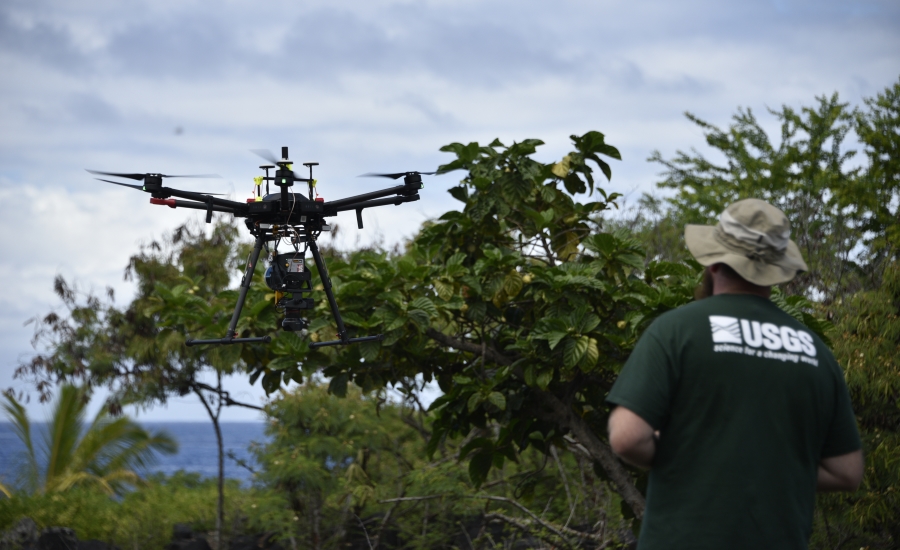
In August 2019, the USGS National Uncrewed Systems Office (NUSO) teamed with the USGS Earth Resources Observation and Science Center (EROS) to collect UAS LIDAR and UAS imagery for developing an updated terrain model to address potential climate change impacts of water-level variability and identify flood hazard inundation zones.
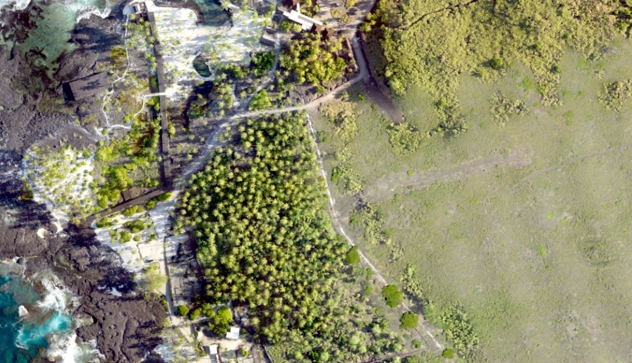
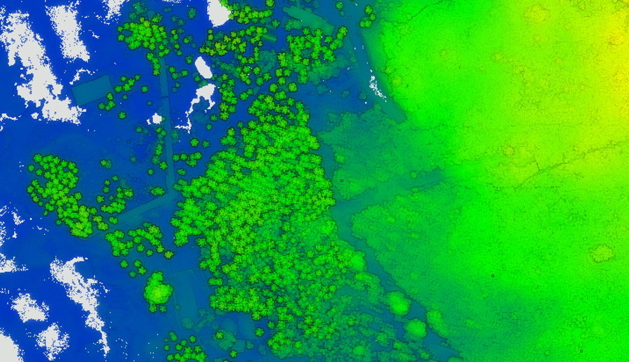
The USGS Coastal National Elevation Database (CoNED) Project, in close collaboration with the University of Hawaii Sea Level Rise Center, and the DOI Pacific Islands Climate Adaptation Science Center (PI-CASC), required an updated centimeter-level coastal elevation dataset for Puʻuhonua o Hōnaunau (PUHO) National Historical Park. This park, which extends along the lava flats of the Kona Coast, is considered a sacred site that preserves the place of refuge or puʻuhonua and is a protected cultural area.
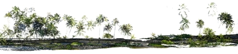
The USGS LiDAR survey, acquired using a Yellowscan Surveyor payload mounted on a DJI Matrice 600 UAS, was corrected using post-processed kinematic (PPK) techniques, covering the north coastal extent of the park. A high-resolution photogrammetric survey was also acquired using a Sony a6000 camera mounted on DJI Matrice 600 UAS. The photogrammetric survey utilized ground control targets acquiring centimeter-level coordinates using a real-time kinematic (RTK) Global Navigation Satellite System (GNSS). These targets served as validation checkpoints for the LiDAR survey. After validation, the LiDAR point cloud served as input to generate a bare-earth terrain model creating a data baseline to address potential climate change impacts of water-level variability, identifying flood hazard inundation zones, near these cultural locations.
Study Points of Contact:
Jeff Danielson, Geographer
U.S. Geological Survey, Sioux Falls, South Dakota
daniels@usgs.gov
MaryAnne Maigret, Supervisory Archeologist/Integrated Resources Program Manager
Pu'uhonua o Hōnaunau National Historical Park
Urban Forest Assessments
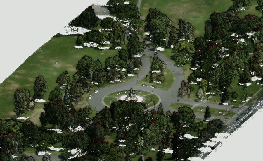
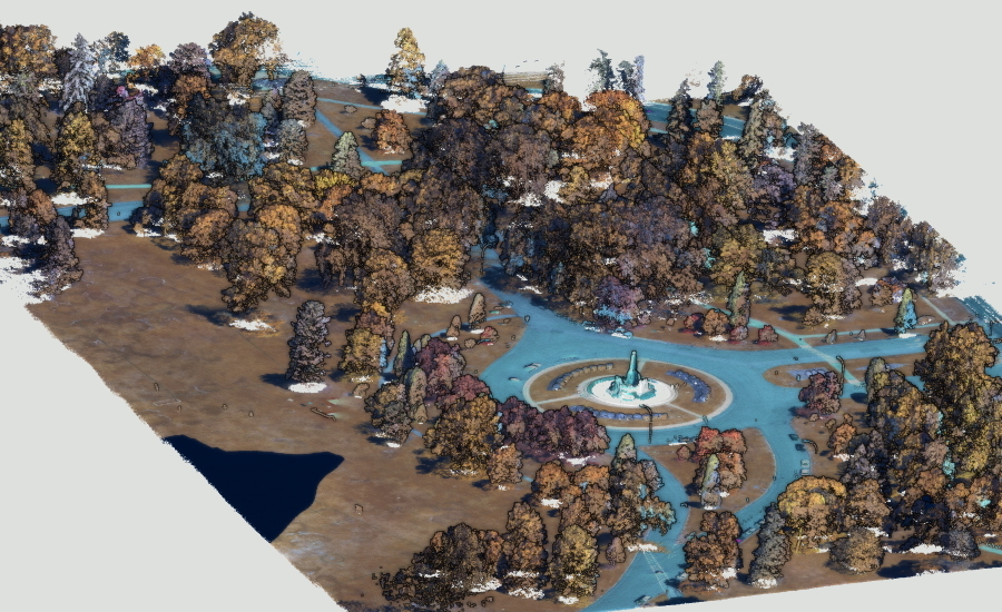
City Park in Denver Colorado
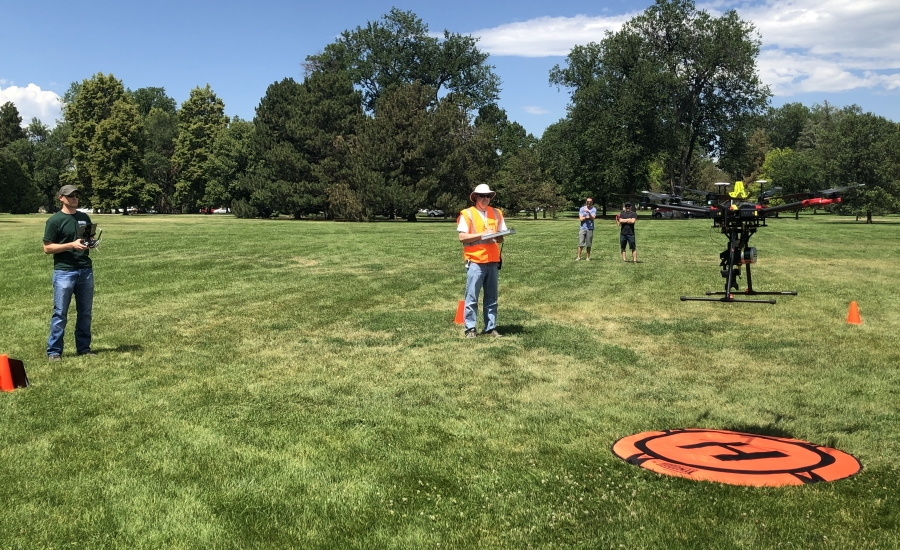
Forest inventory and monitoring are important tools for successful urban forest management. However, comprehensive assessments conducted via first-hand ground-based observations alone can be costly and time consuming. Remote sensing technology provides a data collection methodology capable of stretching limited spatial and temporal resources in forestry. Employing an unmanned aircraft system (UAS) as a low-altitude remote sensing platform has the potential to conduct urban forest inventories and tree health assessments over a large area in a short timeframe, while producing high-resolution data. A multitude of sensors can be flown onboard a UAS to collect imagery and numerical data useful to forestry professionals. Combining visible color imagery with multispectral imagery can be used to differentiate individual tree species and assess their health and condition, while a light ranging and detection (LiDAR) sensor can provide information used to quantify discrete tree morphology and spatial distribution.
This study looked to assess the viability of using various UAS platforms and data collection sensors to characterize and evaluate an urban forest. Flights were conducted monthly during the summer of 2019 at City Park just east of downtown Denver. A 3DR Solo quadcopter equipped with a MicaSense M multispectral camera was flown over the study area during the June flights. A DJI Matrice 600 Pro hexacopter equipped with a Sony A-6000 visible spectrum camera and a Yellowscan Surveyor LiDAR unit was flown during the July data collect. And the Matrice was flown again in September, however the payload used was a MicaSense Altum multispectral camera. Anticipated products include a visible spectrum orthophotomosaic, a color-ramped digital elevation model, a three-dimensional point cloud model, a map of the urban forest as well as classified maps showing individual tree species, tree health, and biometric analyses by month, in addition to temporal changes over the duration of the summer.
Study Point of Contact:
Robert V. Taylor, Physical Scientist
U.S. Geological Survey
rvtaylor@usgs.gov
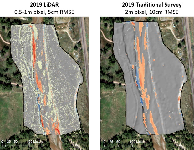
Geomorphic Monitoring to Track Degradation, Aggradation, and Surface Changes
Fountain Creek, Colorado
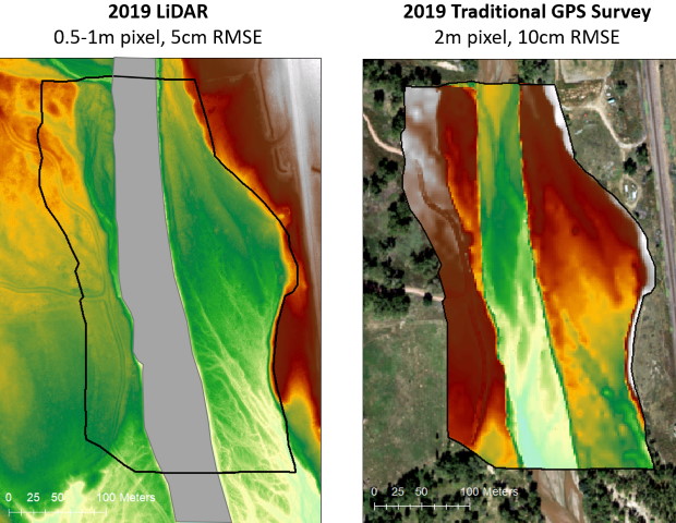
A geomorphic monitoring program implemented by the USGS in collaboration with Colorado Springs Utilities, (CSU) monitors annual changes in stream channel conditions following the implementation of the Southern Delivery System (SDS) water project. The SDS brings water from the Pueblo Reservoir to Colorado Springs for municipal use and returns the treated wastewater to the Arkansas River via Fountain Creek (Water Technology, 2019). In 2012, 10 study areas were established for annual topographic surveys and elevation-change monitoring downstream of the wastewater treatment plant that discharges SDS water. The 10 study areas are located between Colorado Springs and the terminus of Fountain Creek at the Arkansas River in Pueblo.
Between 2012 and 2019, topographic surveys have been conducted manually using RTK-GNSS survey equipment and field crews. With nearly 400 total acres to survey, using manual survey methods require a significant amount of man-power, time, and effort. In 2019, as a proof of concept, USGS surveyed one of the ten study sites with a drone-mounted LiDAR system, producing high-resolution topographic data. This new technique required only 2 field days of data collection instead of the average of 40 days in the field to manually collect the data, and it generated roughly four orders of magnitude of topographic data points. After the purchase of the LiDAR UAS package, costs to collect the topographic data were reduced by 30%. In return, field crew safety and data quality increased significantly.
Study Point of Contact:
Laura Hempel, PhD, Hydrologist
USGS Colorado Water Science Center
lhempel@usgs.gov