
NUSO 2022 Research Missions
UAS lidar for topographic analysis and historical preservation
National Military Park near Vicksburg, Mississippi
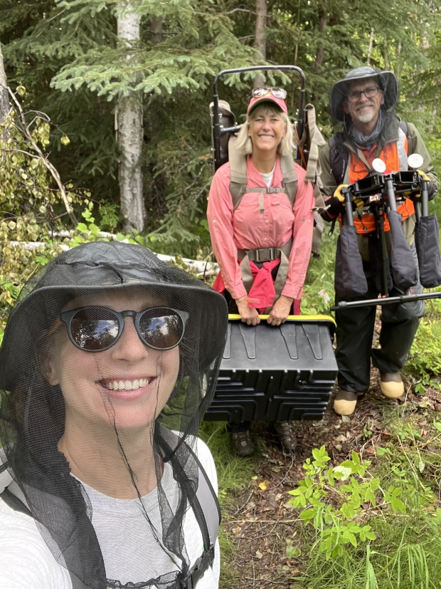
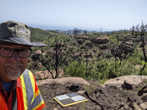
Following heavy rains during a major storm event in 2020, several locations within the park experienced significant soil stability issues impacting historic sites and infrastructure in the park. These unfortunate circumstances prompted Park managers to develop both short-term emergency and long-term plans for mitigation of future damage from extreme weather events.
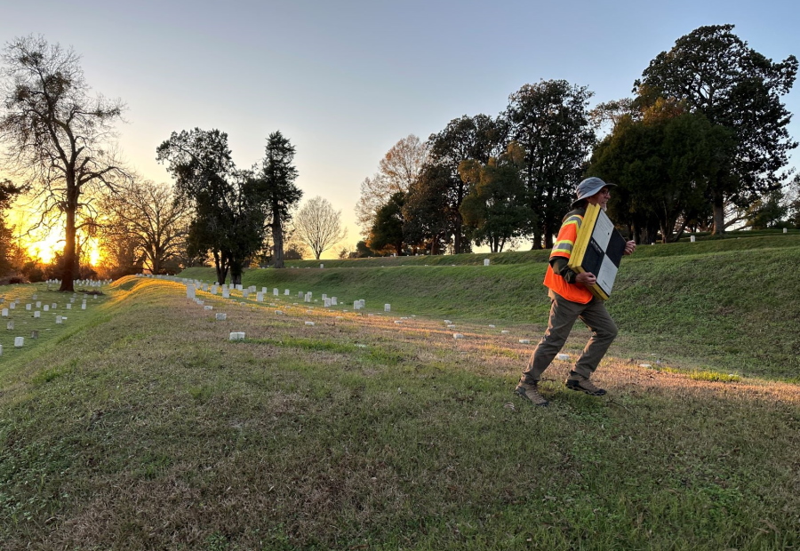
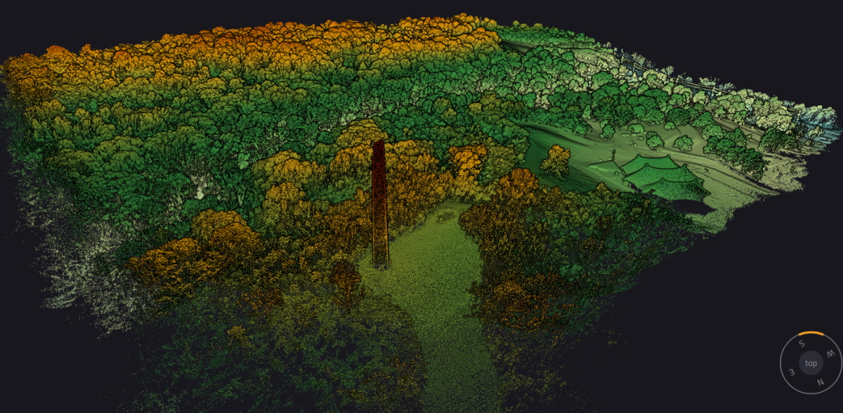
To support mitigation efforts, the USGS NUSO team completed lidar UAS surveys to create point clouds and digital elevation models for analysis. One of the primary objectives was to identify potential landslide locations, and their distribution within the Park boundaries that may not have been easily identified due to their distance from marked trails and access points. Of particular interest were targeted areas of the Park having steep slopes within the rolling hills. Despite poor weather conditions which limited field efforts, much of the northern extent of the Park was surveyed.
Learn more: National Park Service Vicksburg National Military Park
Study Points of Contact:
Joe Adams, IT Specialist & Remote Pilot
NUSO, Geosciences and Environmental Change Science Center
jdadams@usgs.gov
Jessica DeWitt, Research Geographer
U.S. Geological Survey Florence Bascom Geoscience Center
jdewitt@usgs.gov
Smoke Plume Monitoring in Alaska
Fairbanks, Alaska
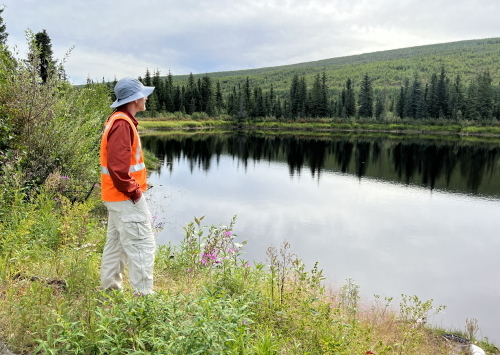
Although the number and magnitude of oil spills have greatly decreased, oil spills can still happen. In-situ burning is one of several tactics that can be employed to quickly mitigate large offshore oil spills. When crude oil burns, black carbon soot can be generated, which can travel downwind. The “Alaska Plume Project” (U.S. Department of the Interior (DOI) Bureau of Safety and Environmental Enforcement (BSEE) Oil Spill Response Research project 1148) aimed to study the smoke emission impacts on first responders and downwind communities using a controlled in-situ burn, smoke particle sampling using Environmental Protection Agency (EPA)’s Kolibri sensor, and subsequent smoke plume modeling by the National Oceanic and Atmospheric Administration (NOAA).
Researchers from the EPA, BSEE, USGS, U.S. Coast Guard (USCG), International Arctic Research Center Uncrewed Aircraft Systems Team, and Alaska Clean Seas gathered at the Poker Flat Research Range near Fairbanks, Alaska to conduct in-situ burns. Ground level and aerial instrumentation were deployed to collect real-time weather and smoke data. During each burn, pilots from the U.S. USGS and USCG flew UAS to collect smoke plume particle data along with natural-color and thermal video data. Alaska Clean Seas personnel safely and efficiently poured, ignited, and cleaned the oil for each in-situ burn.
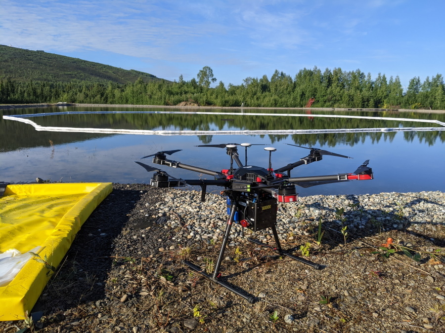
The USGS NUSO flew horizontal, vertical, and downwind plume transects with a DJI Matrice 600 Pro UAS with the Kolibri sensor into the burning oil smoke plume during each of the 7 in-situ burns. Measurements consisted of spatiotemporal measurements of CO2, CO, and PM2.5. On-site meteorology measurements were collected with a balloon-carried weather sonde. USGS NUSO also piloted a Mavic Pro UAS for real time video collection to improve the Kolibri’s positioning within the smoke plume. Overall, the results of this field data collection will improve smoke dispersion modeling to better understand the impacts of in-situ burns during oil spills.
Learn more: EPA Kolibri Sensor
Study Points of Contact:
Brian Gullett, Environmental Engineer
Office of Research and Development, U.S. Environmental Protection Agency
gullett.brian@epa.gov
Karen Stone, Research Program Manager
Response Research Branch, Bureau of Safety and Environmental Enforcement
karen.stone@bsee.gov
Joe Adams, IT Specialist & Remote Pilot
NUSO, USGS Geosciences and Environmental Change Science Center
jdadams@usgs.gov
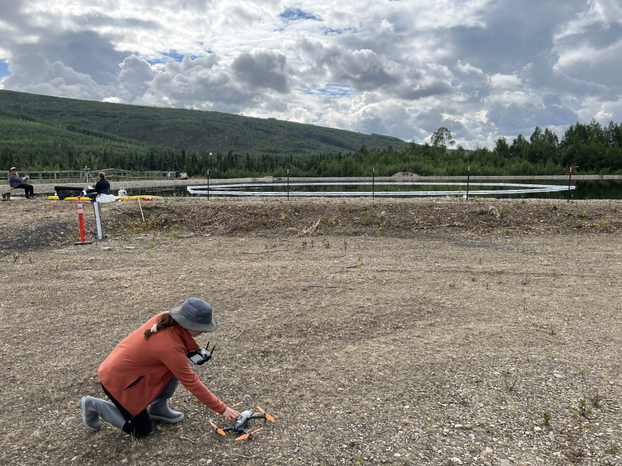
Measuring natural methane emissions from bogs
Fairbanks, Alaska
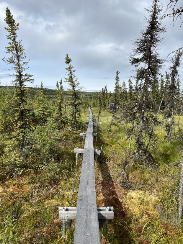
Forested areas cover large parts of Alaska, Canada, and Russia, much of them with permafrost. Permafrost is soil that has been frozen for at least two years, but in reality, has often been frozen for hundreds to thousands of years. These frozen conditions lock up carbon within the soil of these forests. In fact, more carbon is contained in permafrost than plant and atmospheric carbon combined. Scientists expect that the increasing temperatures associated with climate change will likely cause a near-complete thaw of surface permafrost in interior Alaska over the next 100 years. Often this thawing leads to the conversion of permafrost forests to wetlands, such as bogs. These wetlands are a significant source of methane emitted to the atmosphere. Therefore, conversion of forests to bogs will increase the flow (or flux) of methane from the soil to the atmosphere.
The balance of carbon inputs and losses within an ecosystem is often studied using stationary sensors mounted on towers (called flux towers). While these towers provide great 24/7 data, they are expensive to install and maintain. Therefore, they are not usually replicated across the landscape. How can we fill in these observational gaps? The U.S. Geological Survey (USGS) is testing the use of small uncrewed aircraft systems (sUAS) equipped with highly accurate methane sensors to calculate greenhouse gas flux using mass balance and optimization methods. This system will foreseeably allow ecosystem fluxes to be measured across the landscape with relative ease.
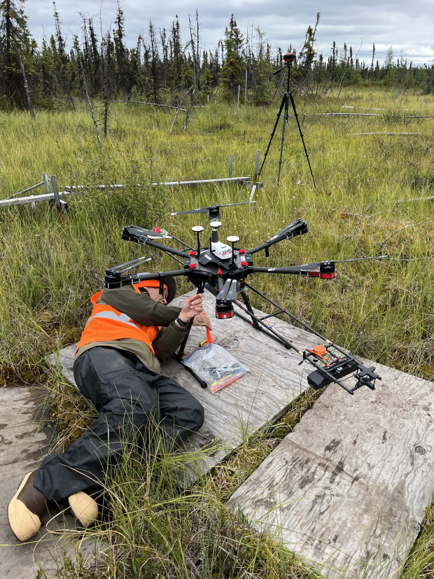
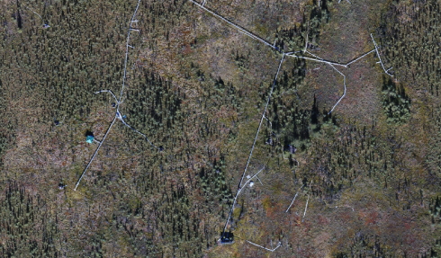
In August 2022 at the Bonanza Creek Long Term Ecological Research Site (BNZ LTER) near Fairbank, Alaska, the USGS National Uncrewed Systems Office (NUSO) flew a DJI Matrice 600 UAS carrying a methane-sensing payload to test different methods to calculate methane flux from a box that also has a flux tower, allowing scientists to compare the two methods. NUSO also flew a DJI Mavic Pro UAS to collect videos and photos for flight planning, science communication efforts, and generating an updated orthomosaic for the BNZ LTER.
Learn more:
A disappearing act in Alaska
Arctic Biogeochemical Response to Permafrost Thaw (ABRUPT)
Study Points of Contact:
Kristen Manies, Ecologist
USGS Geology, Minerals, Energy, and Geophysics Science Center
kmanies@usgs.gov
Joe Adams, IT Specialist & Remote Pilot
NUSO, USGS Geosciences and Environmental Change Science Center
jdadams@usgs.gov
Harmful Algal Blooms (HABs) Remote Sensing Field Campaign
Leetown, West Virginia
Harmful algal blooms (HABs) are rapid growths of algae in bodies of water with associated toxins that can affect water quality, aquatic ecosystems, and even threaten the health of nearby humans and animals. In support of studying algae life cycles, environmental triggers, and growth patterns, an interdisciplinary collection of USGS scientists from across the country gathered to participate in a proof-of-concept project involving remote sensing of HABs.
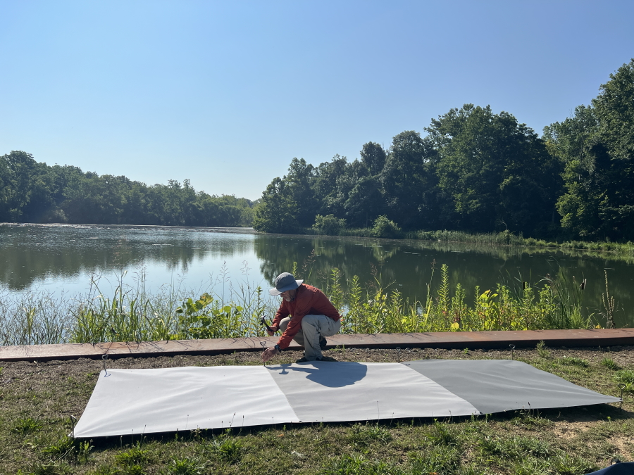
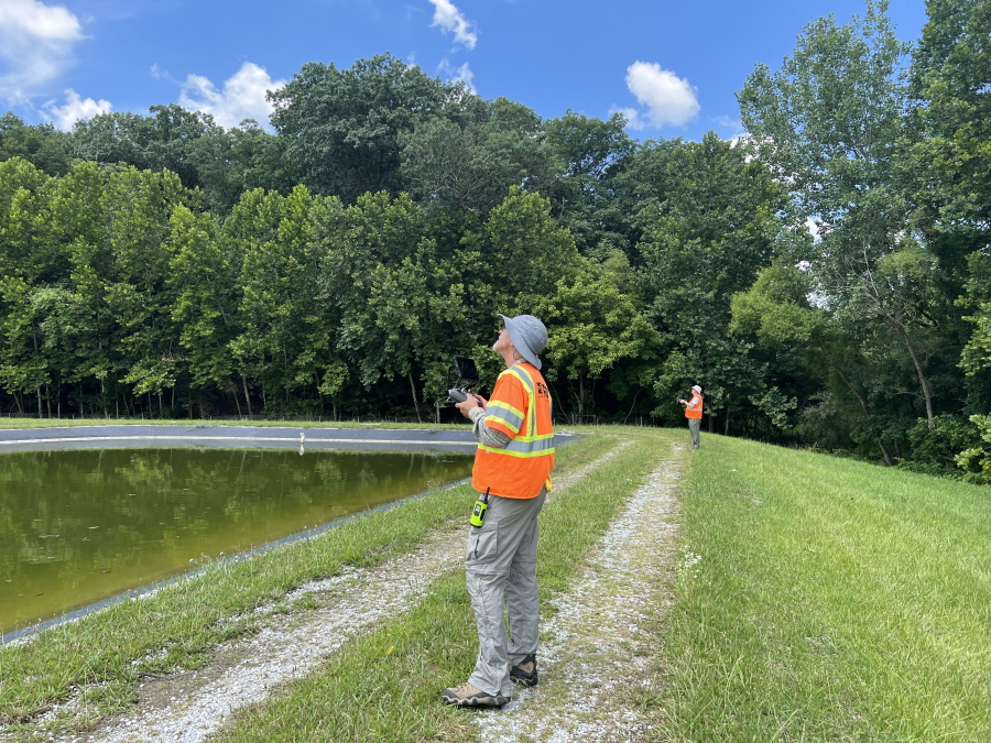
The goal was to examine and develop remote sensing capabilities to image and identify algae species presence and growth in a controlled setting: 14 large, lined ponds at the Eastern USGS Eastern Ecological Science Center - Leetown Research Laboratory (EESC-LRL) located in Leetown, West Virginia. Field-based teams collected water temperature, algae, and vegetation samples which were subsequently sent to USGS labs for spectral and chemical analysis.
This project involved immense coordination between domain experts in ecology, geography, hydrology, and microbiology as well as managing complex logistics onsite, in laboratories, and at the airborne and spaceborne levels. Multi-scale remote sensing observations were collected via lab-based cameras and microscopes, handheld field spectrometers, UAS flights, and low-earth orbit satellites, the space station.
The USGS NUSO collected UAS-based hyperspectral (Headwall Nano and Resonon Pika-L), 10-band multispectral (MicaSense Dual), lidar (Yellowscan Mapper) and true-color data coincident with satellite overpasses during this field campaign. The USGS Oregon Water Science Center also collected UAS coincident hyperspectral imagery (Resonon Pika-L) for comparison and educational purposes as both offices are developing and refining their hyperspectral data collection and processing procedures. Ortho-rectified reflectance orthomosaics and digital elevation data products will be provided as an intermediate scale of observations to support HABs research at USGS.
Study Points of Contact:
Peter Rinkleff, Associate Center Director for Science
USGS National Civil Applications Center
prinkleff@usgs.gov
John Young, Remote Sensing and GIS Team Lead
USGS Eastern Ecological Science Center - Leetown Research Laboratory
jyoung@usgs.gov
Natalie Hall, Physical Scientist
USGS MD-DE-DC Water Science Center
nhall@usgs.gov
Joe Adams, IT Specialist & Remote Pilot
NUSO, USGS Geosciences and Environmental Change Science Center
jdadams@usgs.gov
Post-wildfire soil and vegetation monitoring
Santa Rosa, California
Northern California experienced a record-breaking wildfire season in 2020. Wildfire increases a landscape’s susceptibility to flooding and erosion, which can pose threats to nearby ecosystems and human communities. Researchers at USGS Science Centers in Northern California including USGS Western Geographic Science Center, Geology, Minerals, Energy, and Geophysics Science Center, California Water Science Center, and the National Innovation Center are conducting repeat field and remote sensing data collections to study the hydrological impacts of wildfire across several site in northern California.
Joe Adams (USGS NUSO) collected natural-color and multispectral UAS imagery in April 2022, which will be used to generate photogrammetric data products including an orthomosaic and a structure-from-motion derived point cloud. High resolution (1-4cm) UAS imagery was also collected in 2021. The multi-year data collection will be used to assess soil and vegetation recovery over time.
Learn more about this ongoing research: Characterizing high-resolution soil burn severity, erosion risk, and recovery using Uncrewed Aerial Systems (UAS)
Study Points of Contact:
Joe Adams, IT Specialist & Remote Pilot
NUSO, USGS Geosciences and Environmental Change Science Center
jdadams@usgs.gov
Miguel Villareal, Ph.D., Research Geographer
NASA AMES-Moffett Field, USGS Western Geographic Science Center
mvillarreal@usgs.gov
Mapping snowpack with lidar point clouds
Winter Park and Berthoud Pass, Colorado
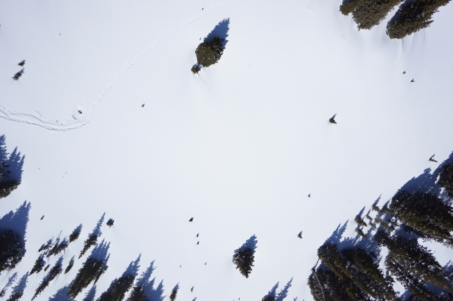
Accurately measuring snow depth is crucial for calculating snow water equivalent (SWE), the amount of water in snow, that plays a key role in estimating snowmelt runoff and the seasonal water amounts that will enter various watersheds.
NUSO researchers are working to develop and verify methods for generating snow-depth maps from UAS collected lidar point cloud data as part of an initiative between the USGS Next Generation Water Observing System (NGWOS) and Colorado Department of Transportation (CDOT). This multi-year initiative is aimed at collecting and comparing on-the-ground snow measurements, taken from snow pits, snow probes, and snow cores, to snow depths derived from remotely sensed data. The ability to utilize UAS data collection for snow-depth measurements could also contribute to the NGWOS goal to cover currently unmonitored watershed areas.
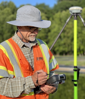
The USGS field team conducted three separate UAS data collects of the Winter Park, Colorado study site in September 2020, February 2021, and April 2021. During each of these missions USGS collected topographic data in a lidar point cloud (LPC) format from a YellowScan VX20-100 lidar payload, a lidar scanner and integrated inertial navigation unit, mounted on a UAS. Natural color imagery was also collected, and ground-based targets were surveyed for control and accuracy validation. After successfully processing the lidar point cloud (LPC) data a bare-earth digital elevation model and a snow-surface model (vegetation removed) were generated. Snow-depth maps were then created by subtracting the bare-earth terrain from the snow-surface model. And as a final product the orthomosaic created from the natural color imagery was used to colorize the LPC data.
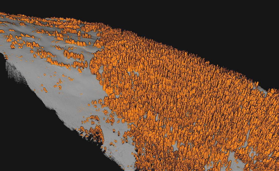
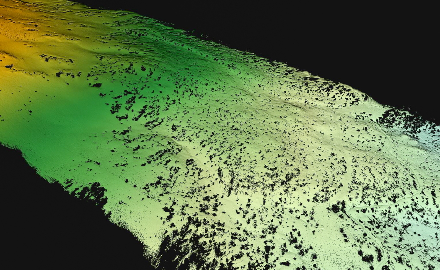
In March and April of 2022, NUSO performed new UAS lidar and natural color data collection missions over the Berthoud Pass study site in Colorado. NUSO flew a UAS mounted with the YellowScan Mapper lidar payload with a RGB camera module to enable photogrammetry and colorizing of the point cloud data. Work is currently underway to process the collected data and generate the various maps and models to assist with mapping spatial and temporal variations in snowpack.
USGS Featured Story: Get to know the scientists behind snow to flow: The study of snowmelt in the Western U.S.
Study Point of Contact:
Graham A. Sexstone, PhD, Research Hydrologist
U.S. Geological Survey
sexstone@usgs.gov
Biocrust Remote Sensing
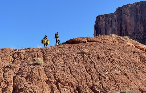
Moab, Utah
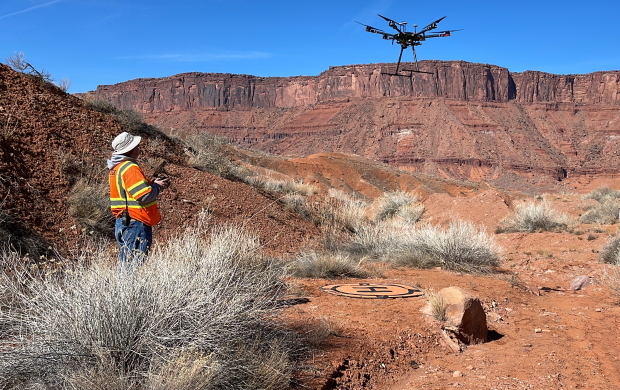
Biological soil crusts (biocrusts) are diverse communities of organisms including lichen, moss, and cyanobacteria living on soil surfaces in arid environments around the world. Although biocrusts play important roles in water and carbon cycling, there is great uncertainty and many unanswered questions related to their presence and function. Researchers at the USGS Canyonlands Research Station maintain a long-term biocrust monitoring site near Moab, Utah to study the effects of a warming climate and precipitation changes on biocrust community behavior and composition. Ground-based measurements including soil moisture, biocrust and vegetation species composition, and gas exchange are collected regularly at plots receiving various temperature and watering treatments.
Remote sensing technologies provide opportunities to scale up observations of how biocrusts respond to environmental changes. In February 2022, researchers from the USGS Canyonlands Research Station, USGS Western Geographic Science Center, University of Arizona School of Natural Resources and the Environment, and the USGS National Uncrewed Systems Office (NUSO) teamed up to collect a series of coincident field-based and UAS remote sensing data at the biocrust monitoring plots. The USGS NUSO conducted a series of UAS flights carrying six different sensors to collect natural-color RGB (Ricoh GRII), thermal (Zenmuse XT2), multispectral (MicaSense MX-Dual; MicaSense Altum), and hyperspectral (Resonon Pika-L; Headwall Nano) remote sensing imagery across the extent of the biocrust monitoring plots.
Using this imagery, NUSO will generate a series of spectral and structural photogrammetric data products including reflectance orthophotomosaics, digital elevation models, and three-dimensional structure-from-motion point clouds. Ground based measurements collected during the UAS flights included spectral reflectance profiles of land cover types and biocrust/vegetation species, plot-level thermal and RGB images, and gas exchange measurements. Multiple satellite overpasses occurred during the field campaign to enable further cross-scale remote sensing analyses.
Study Points of Contact:
Sasha Reed, Ph.D., Research Ecologist
Canyonlands Research Station, Southwest Biological Science Center
screed@usgs.gov
Miguel Villareal, Ph.D., Research Geographer
NASA AMES-Moffett Field, Western Geographic Science Center
mvillarreal@usgs.gov
Matthew Burgess, Ph.D., UAS Operations / Geospatial Analyst
National Uncrewed Systems Office, Geosciences and Environmental Change Science Center
maburgess@usgs.gov