
NUSO 2023 Research Missions
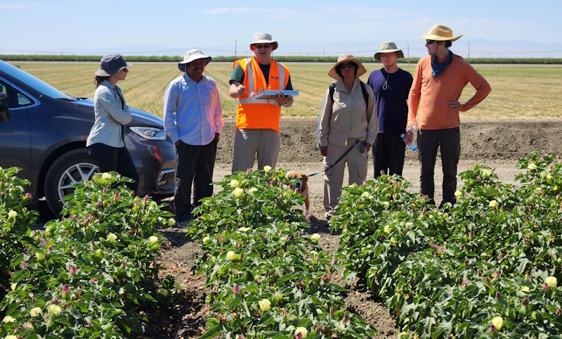
UAS Hyperspectral Crop Field Mapping
Firebaugh, CA
A new generation of satellite-based hyperspectral sensors will provide hundreds of bands of spectral remote sensing data from space: German DLR Earth Sensing Imaging Spectrometer (DESIS), Environmental Mapping and Analysis Program (EnMAP), and Italian PRecursore IperSpettrale della Missione Applicativa (PRISMA). Research Geographer Dr. Itiya Aneece and Senior Scientist Dr. Prasad Thenkabail at the USGS Western Geographic Science Center are studying ways to assess crop productivity, health, yield, lignin and cellulose content using these spaceborne hyperspectral systems.
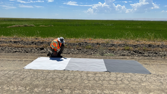
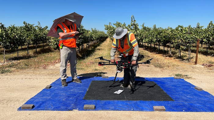
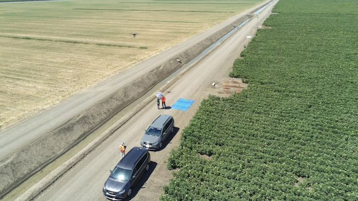
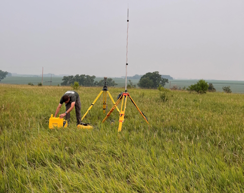
In August 2023, the USGS National Uncrewed Systems Office (NUSO) participated in a collaborative field campaign to collect several types of remote sensing data over crop fields. Hyperspectral satellites were commissioned in coordination with UAS flights at an altitude of 300 feet above ground level and ground-based spectral measurements collected using an ASD FieldSpec instrument. USGS NUSO collected hyperspectral image data over a variety of crop fields: cotton, almond, pistachio, grape, rice, and corn. The hyperspectral UAS imagery will be calibrated to reflectance and ortho-rectified for comparison with spaceborne and ground-based observations.
Study Point of Contact:
Itiya Aneece, Research Geographer
Western Geographic Science Center
ianeece@usgs.gov
Using UAS to Support Road Condition Inspections on Federal Lands
Alamosa National Wildlife Refuge, Alamosa, Colorado
In addition to protecting and managing the lands and resources under their jurisdictions, Federal Land Management Agencies (FLMAs) are vitally interested in the maintenance of a public road system that provides access for the use, management, and enjoyment of Federal lands. FLMAs work to ensure that their road construction, maintenance, and operations activities are carried out in ways that minimize impacts on operations while complying with adopted standards and federal law regarding highways. Understanding that roads deteriorate over time due to traffic loading and environmental factors and preventive maintenance can be significantly less expensive than rehabilitation or reconstruction, FLMAs periodically inspect their roadway networks to help minimize the maintenance backlog, while also exploring ways to improve their inspection processes.
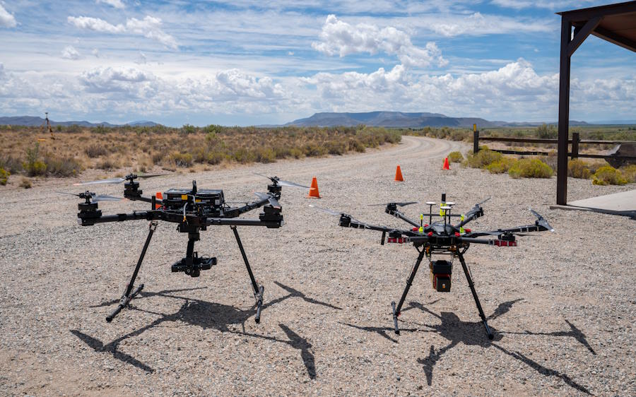
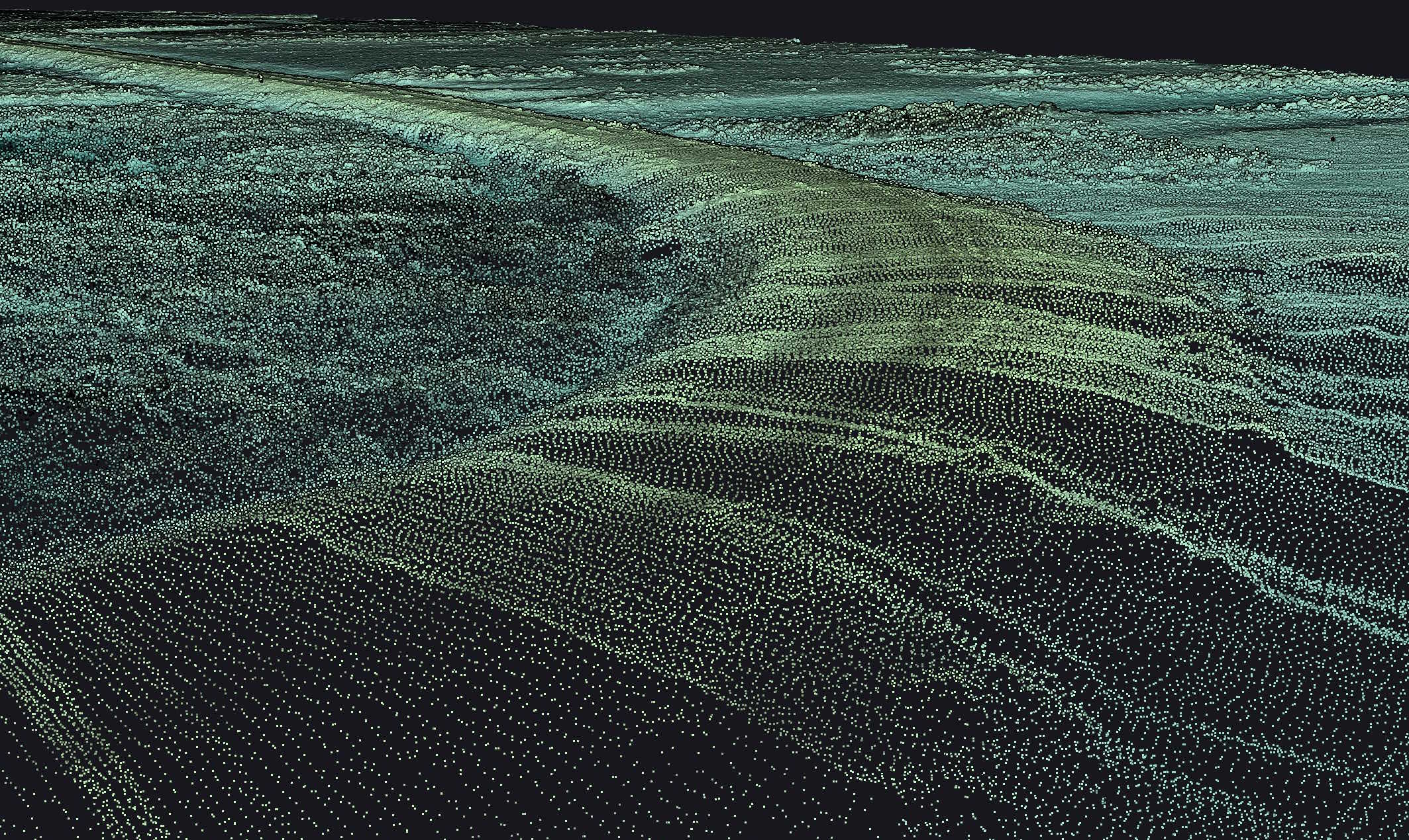
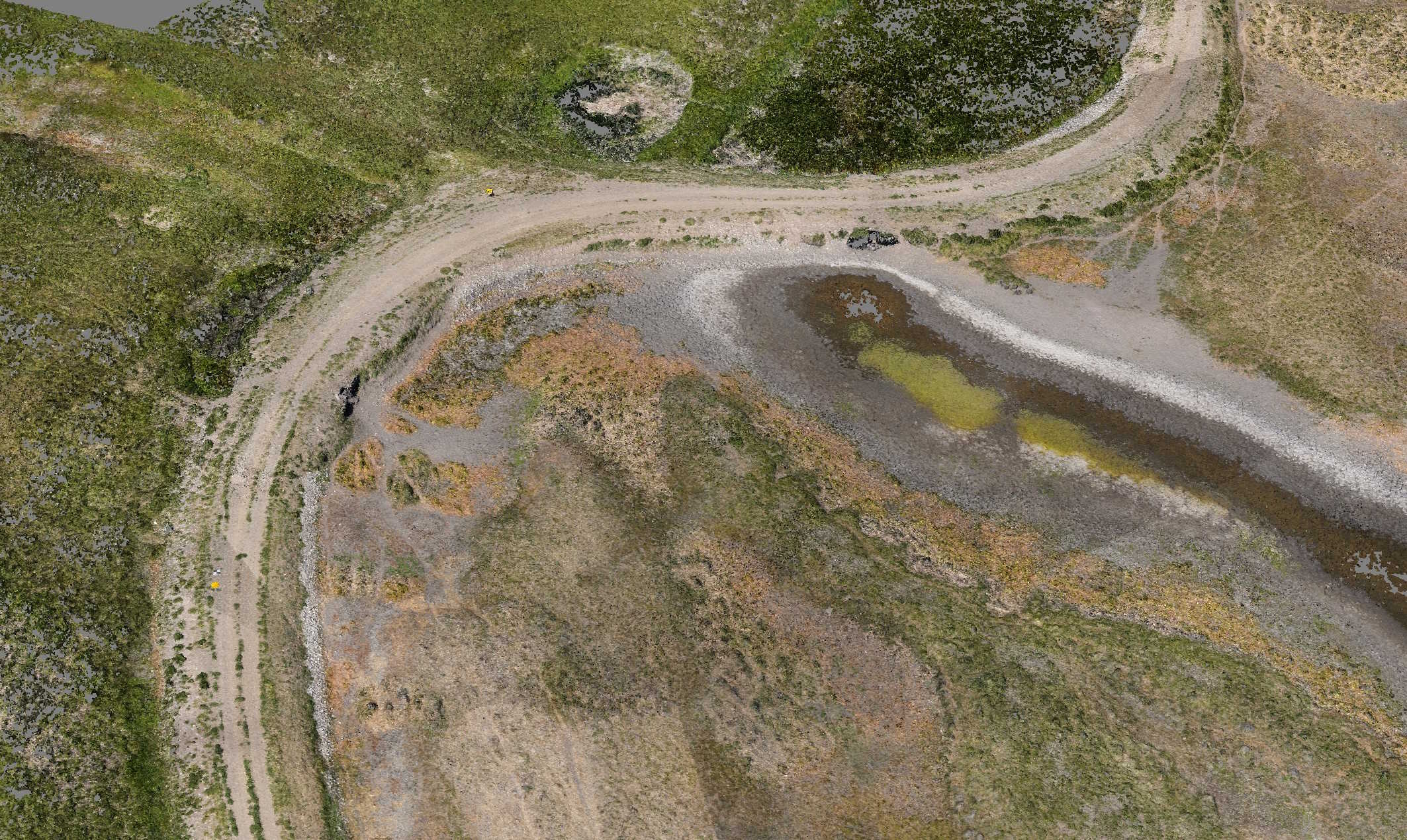
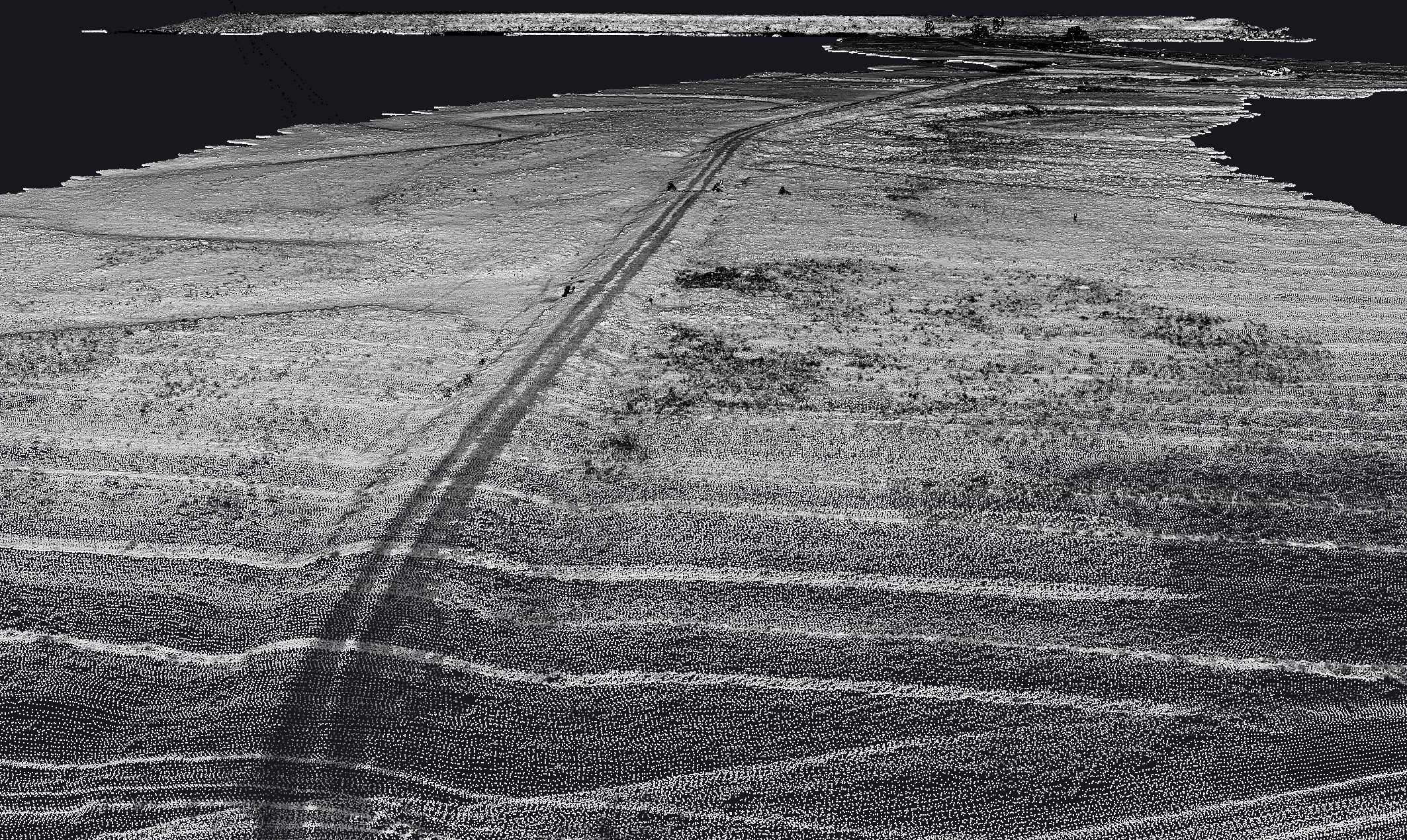
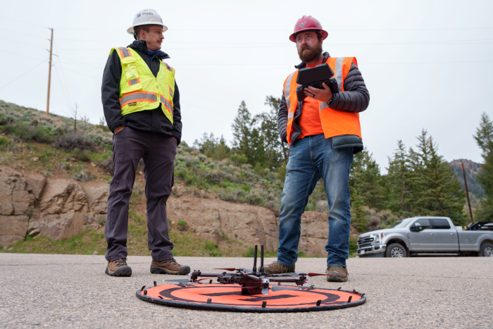
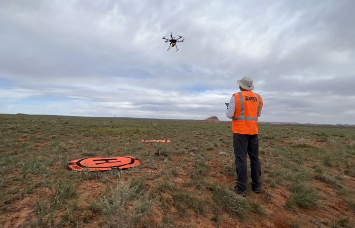
Accordingly, the U.S. Fish and Wildlife Service (FWS) undertook a research effort with the U.S. Department of Transportation’s (DOT) Volpe National Transportation Systems Center (Volpe Center) to identify opportunities, challenges, and needs related to using UAS to support condition inspections on FLMA roads. Alamosa National Wildlife Refuge (Alamosa) in Colorado served as a testbed for applying and assessing UAS concepts reviewed in a literature scan and insights gathered from interviews with subject matter experts. In coordination with the FWS and the Volpe Center, NUSO participated in a two-day demonstration and evaluation of the YellowScan VX20-100 lidar payload on a UAS for assisting with unpaved road condition inspections at Alamosa. NUSO’s Mark Bauer led the interagency team in the field in placing ground control points and planning, coordinating, and conducting flight missions; UAS pilots from the Federal Highway Administration’s (FHWA) Office of Federal Lands Highway flew complementary missions with their UAS equipment after NUSO’s missions were flown. Multiple flights were conducted to acquire both lidar and imagery data. The Volpe Center is tasked to assess whether the presence and severity of road distress on unpaved roads can be discerned via remote sensing techniques to generate a condition rating for a road. The FWS and Volpe Center team expect to complete a final report for the research project by the end of the calendar year 2023.
Study Points of Contact:
Mark Bauer, Geographer & Remote Pilot
National Uncrewed Systems Office, Geosciences and Environmental Change Science Center
mabauer@usgs.gov
Peter Tomczik, Transportation Asset Management Coordinator
Branch of Transportation and Data Management, United States Fish and Wildlife Service
peter_tomczik@fws.gov
UAS Measurements of Methane in Interior Alaska
Fairbanks, Alaska
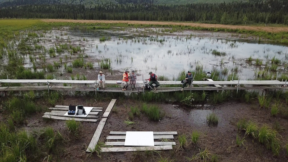
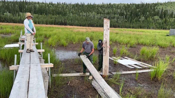
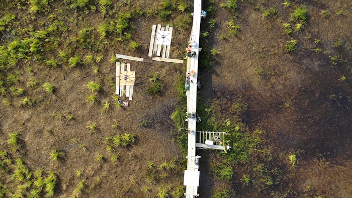
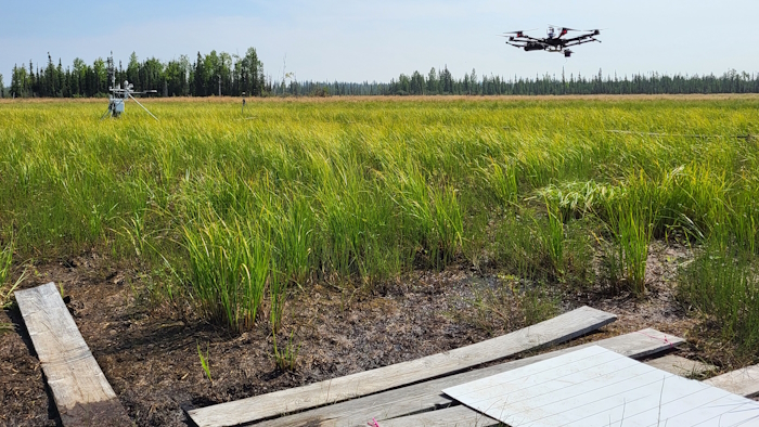
As permafrost soils in the Arctic warm and thaw, greenhouse gases including methane are released into the atmosphere. USGS ecologist Kristen Manies, of the USGS Geology, Minerals, Energy, and Geophysics Science Center (GMEGSC), is researching low-cost ways to measure methane emissions across these changing ecosystems. Scientists have traditionally monitored methane emissions using ground-based flux towers and surface chambers. While these methods provide valuable data, the measurements techniques are resource intensive and, therefore, are done in limited areas. A crewed helicopter at low altitude increases personnel risk, has the potential to disturb wildlife, and would have difficulty getting low enough to accurately measure these emissions. Uncrewed aircraft systems (UAS), also known as drones, may enable scientists to significantly enhance their data collection capabilities at wetlands across Alaska.
In 2023, the USGS National Uncrewed Systems Office (NUSO) flew UAS equipped with custom methane-detecting sensors in support of Manies’ climate research in collaboration with the U.S. Environmental Protection Agency (EPA) Office of Research and Development. UAS surveys at various altitudes and flight patterns were conducted at the Bonanza Creek Long-Term Ecological Research Site (BNZ LTER) located approximately 20 km southwest of Fairbanks, Alaska. Drone-based methane observations were collected with two distinctive custom methane-sensing payloads by USGS and EPA researchers for inter-comparison and with fixed tower-based measurements at BNZ LTER.
- USGS Climate research and development program: Arctic Biogeochemical Response to Permafrost Thaw (ABRUPT)
- Climate Research and Development Program
Study Points of Contact:
Kristen Manies, Ecologist
USGS Geology, Minerals, Energy, and Geophysics Science Center
kmanies@usgs.gov
Brian Gullett, Environmental Engineer
Office of Research and Development, U.S. Environmental Protection Agency
gullett.brian@epa.gov
Radiometric calibration and validation research for scientific-grade spectral UAS imagery
Earth Resources Observation and Science (EROS) Center in Sioux Falls, SD
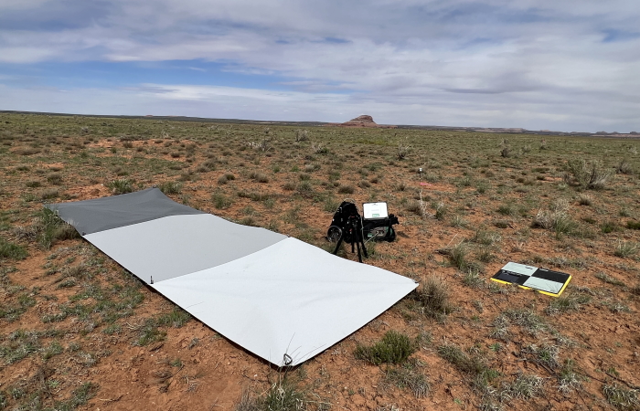
The Earth Resources Observation and Science (EROS) Calibration/Validation Center of Excellence (ECCOE) is responsible for the radiometric and geometric characterization and calibration of Landsat satellite instruments. Spaceborne sensors such as those onboard the Landsat satellites are rigorously characterized and calibrated using both laboratory and onboard techniques to generate science-grade data products. Although UAS technologies offer flexible opportunities to capture low-altitude remote sensing data, their low-cost sensors and variable environmental conditions during data collection create challenges for radiometric calibration. Developing UAS calibration protocols and quantifying sources of uncertainty are active areas of research in the remote sensing community.
In support of radiometric calibration and validation research activities at USGS, the National Uncrewed Systems Office (NUSO) collected AgEagle/MicaSense RedEdge MX-Dual 10-band multispectral and Headwall Nano-Hyperspec 274-band hyperspectral UAS imagery at the EROS Center in Sioux Falls, SD. Over the course of four days and various environmental conditions (wildfire smoke, partly cloudy, and clear skies), UAS flights were conducted at approximately 10am , 12pm, and 1-2pm each day to capture different solar geometries. ECCOE scientists measured a series of reflectance targets and a large, vegetated site using handheld spectrometers in close time proximity to the UAS collections and overpasses by Landsat 9 and Sentinel 2B.
The data collected in coordination between NUSO and ECCOE will enable USGS researchers to explore questions related to calibration panel materials, colors, and sizes for UAS imagery calibration procedures. In conjunction with satellite overpasses, the UAS data collected during this mission may also provide value for satellite data validation studies.
Learn more:- EROS CalVal Center of Excellence (ECCOE)
- Open File Report: Guidelines for calibration of uncrewed aircraft systems imagery
Study Point of Contact:
Jeff Irwin, Geographer & Field Team Lead
EROS Calibration/Validation Center of Excellence (ECCOE)
jrirwin@usgs.gov
Monitoring Topographic, Vegetation, and Habitat change using UAS
Yosemite National Park, California
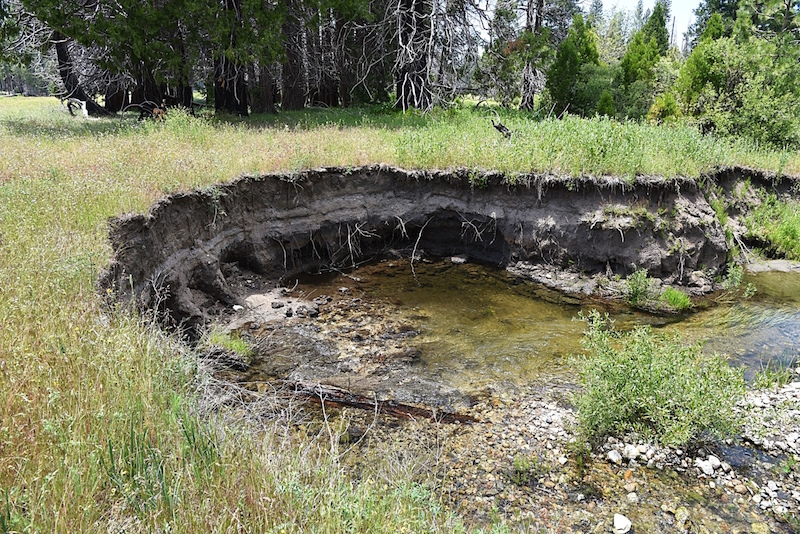
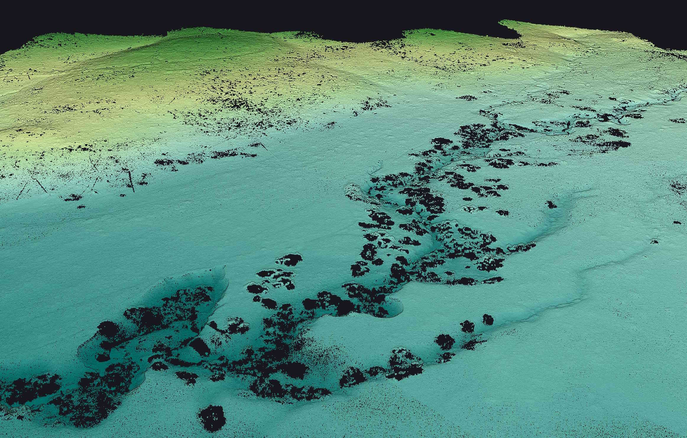
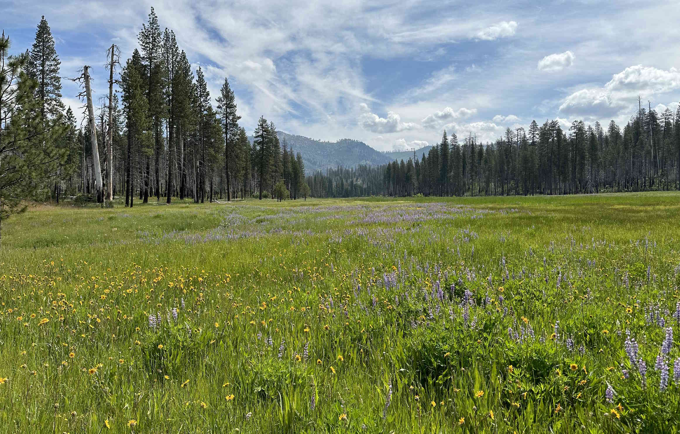
Ackerson Meadow is a newly acquired addition to Yosemite National Park and is one of the largest mid-elevation meadows in the Sierra Nevada and the largest in the Park. It is an ecologically and regionally critical wildlife corridor and the scenic meadow is an important habitat for the State’s endangered great Grey Owl and Little Willow Flycatcher, as well as a suite of additional at-risk wildlife species. It was purchased from private ownership in 2016 and donated to Yosemite by a coalition including the Trust for Public Lands, National Park Trust, Yosemite Conservancy, and American Rivers. A large gully network, up to 3 miles long, 14 feet deep, and 100 feet wide has drained 90 acres of wetlands in the meadow complex and is actively eroding an additional 100 acres of remaining wetlands and wet meadow habitat. The gully network is likely a result of over a century of landscape manipulation including domestic water diversion, farming, ranching, and timber harvest. Yosemite National Park and Stanislaus National Forest have partnered with American Rivers and Yosemite Conservancy to implement actions that reduce erosion and restore wetland functionality at Ackerson Meadow. These actions include filling eroded gullied with soils and sediment from nearby locations and revegetating the restored area. Source: NPS https://www.nps.gov/yose/getinvolved/ackersonmeadow.htm
The U.S. Geological Survey’s National Uncrewed Systems Office (NUSO) partnered with USGS scientists and the National Park Service to collect high-resolution UAS lidar datasets and photogrammetric imagery of the Main and South Ackerson Meadows. This collaboration allows USGS to provide unbiased science to support decision-making by Park Service managers and to provide data essential to NPS and other scientists involved in the restoration project. The data collected are part of a time series study of detailed topography, vegetation, and habitat structure related to the restoration. UAS data collections were completed for pre-restoration work in June 2023. Additional fieldwork collections are planned for the early restoration phase in November of 2023, for post-restoration (native revegetation) in 2024, and further monitoring in 2025.

Study Points of Contact:
Stephen (Steve) DeLong, Supervisory Research Geologist
USGS Southwest Region
sdelong@usgs.gov
Mark Bauer, Geographer
NUSO, Geosciences and Environmental Change Science Center
mabauer@usgs.gov
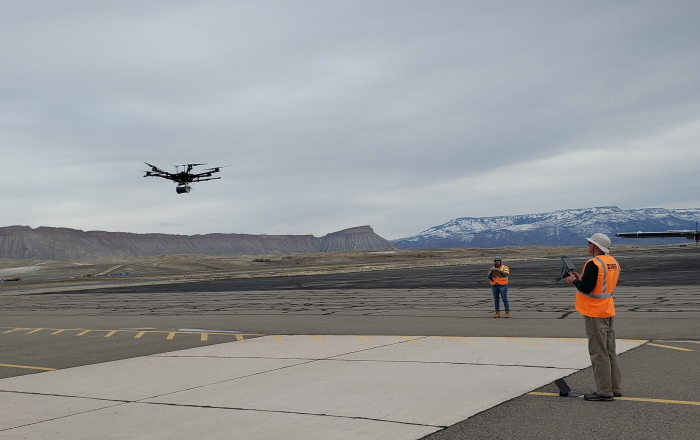
Test and Evaluation of UAS 3D scan for bridge inspection
Green Mountain Reservoir U.S. Bureau of Reclamation facility
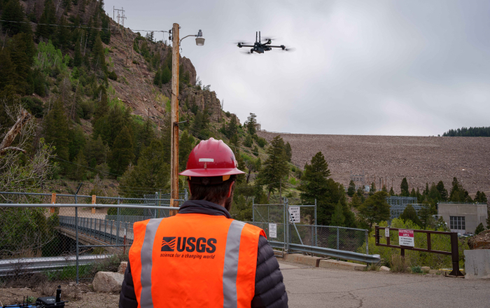
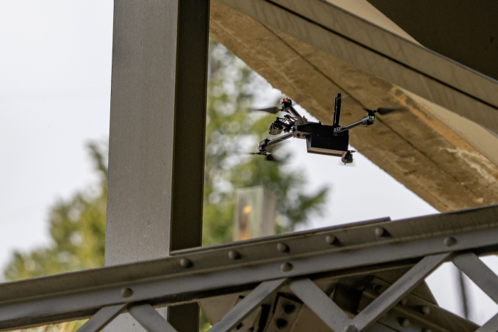
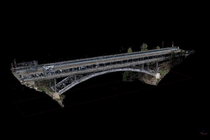
NUSO is conducting evaluations of uncrewed aircraft systems (UAS) to find suitable replacements for the existing Department of the Interior (DOI) UAS fleet. The Skydio X2D is a 4th generation DOI UAS that has sophisticated artificial intelligence algorithms running on the flight controller while also using 360-degree obstacle avoidance cameras. This allows the aircraft to perform fully autonomous photogrammetric missions in confined, GPS-denied environments. NUSO is testing the Skydio X2D 3D scan capability to create photogrammetric models to assist infrastructure assessment teams at bridges and dams.
Working alongside Civil Engineer Matthew Klein’s team from the U.S. Bureau of Reclamation, NUSO participated in a test and evaluation of the Skydio X2D uncrewed aircraft’s 3D scan capability for assisting with infrastructure inspections near Heeney, Colorado at the Green Mountain Reservoir. NUSO team members placed a series of ground control points and scale bars to assist with the processing of the photogrammetric models. Multiple flights were conducted that focused on the main bridge deck, bridge supports, and bridge substructure. Several visual observers were present including Rich Thurau of the DOI Office of Aviation Services to maintain visual site of the aircraft during the scan. Since these were the first flights using the Skydio in confined spaces, more care was taken to track the aircraft. Matt Chandler, Aaron Begle and Taylor Mitcham from Skydio were also present to assist with 3D scan parameters and provide support. The aircraft performed as advertised with little to no input from the remote pilot during the scan. Independent review of the Skydio imagery showed it is possible to acquire a high-quality camera calibration for the Skydio imaging systems allowing for a highly accurate photogrammetric model.
Learn more: USBR Green Mountain Powerplant
Study Points of Contact:
Todd Burton, Regional Aviation Manager & Remote Pilot
NUSO, Geosciences and Environmental Change Science Center
tburton@usgs.gov
Mark Bauer, Geographer
NUSO, Geosciences and Environmental Change Science Center
mabauer@usgs.gov
UAS multi-scale remote sensing for carbon sequestration on public lands
Moab, Utah
USGS Research Ecologist Dr. Sasha Reed and her collaborators are studying ways to quantify and manage carbon sequestration across drylands. Although satellites offer global remote sensing coverage and a long-term data record, estimates of aboveground biomass and plant productivity via spectral indices are known to under-perform in drylands. The Bureau of Land Management (BLM) measures field-based aboveground biomass at Assessment, Inventory, and Monitoring (AIM) sites spread across public lands in the west. However, BLM AIM plots require intensive sampling and offer finite observations over large areas.
The National Ecological Observatory Network (NEON) has a long-term monitoring site located on high-desert BLM land 25 miles south of Moab, Utah. In addition to collecting meteorological, soil, vegetation, and wildlife observations, NEON collects and delivers freely available airborne remote sensing data at this site on a semi-annual basis. NEON’s airborne system collects lidar, spectrometer and high-resolution RGB camera data.
Uncrewed aircraft systems (UAS) provide a high spatial resolution (2-4cm) perspective that can help connect BLM AIM field measurements to airborne and satellite observations. In May 2023, USGS NUSO coordinated with BLM and NEON to collect field, UAS, and airborne data at the NEON Moab site. NEON collected airborne data at a flight altitude of 1000 meters above ground level (AGL) on April 28. During the following week, USGS NUSO collected UAS natural-color, multispectral, hyperspectral, and lidar data at a flight altitude of 31 meters over two BLM AIM plots that were imaged by the NEON's airborne platform. BLM AIM teams collected field-based measurements of vegetation and soil at these two sites. USGS researchers will link these data sets to inform carbon storage questions on public lands.
- Bureau of Land Management (BLM) Assessment, Inventory, and Monitoring (AIM)
- National Ecological Observatory Network (NEON)
- NEON MOAB site
Study Points of Contact:
Victoria Scholl, Physical Scientist & Remote Pilot
National Uncrewed Systems Office, Geosciences and Environmental Change Science Center
vscholl@usgs.gov
Sasha Reed, Ph.D., Research Ecologist
Canyonlands Research Station, Southwest Biological Science Center
screed@usgs.gov
Brooke Osborne, Professor, Environment & Society
Utah State University
brooke.osborne@usu.edu
Jason Burgess-Conforti, Monitoring Coordinator/Ecologist
Assessment, Inventory, and Monitoring (AIM), Bureau of Land Management
jburgessconforti@blm.gov
UAS Mapping of Pleistocene Fossilized Trackways
White Sands National Park in New Mexico
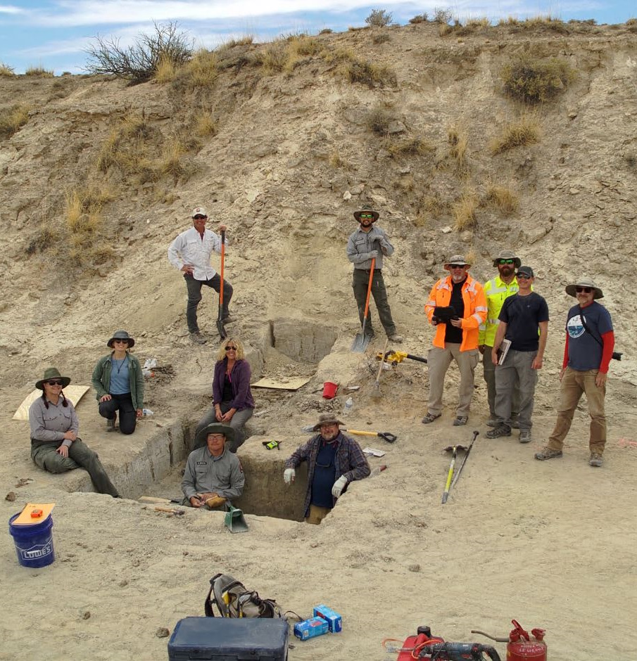
Although White Sands National Park is widely recognized for its wave-like gypsum sand dunes, this national park is also home to the world’s most extensive collection of fossilized footprints from the Pleistocene epoch. These fossilized tracks were left by ice age megafauna including mammoths, giant ground sloths, dire wolves, and even footprints left by humans along the shores of the ancient Lake Otero in the Tularosa Basin. These footprints are the subject of globally significant archeological research: The oldest human footprints in North America were recently discovered at White Sands, changing the timeline of human arrival in the Americas by nearly 10,000 years (Bennett et al. 2021).
Soil stability, erosion, moisture, and activity at the nearby White Sands Missile Range pose a threat to these ephemeral fossilized tracks. White Sands National Park personnel are exploring the use of uncrewed aircraft systems (UAS) to advance their preservation and applied research capabilities. UAS are scientific tools that could be used to reduce the destructive impact of work around trackway sites and to digitally capture trackways for future studies.
In April 2023, NUSO collected scientific UAS data at White Sands National Park to document trackways before erosion erases them. NUSO collected natural-color and lidar data at a variety of flight altitudes and spatial scales at multiple sites with known fossilized footprints. Note that the UAS data collected at White Sands National Park is protected and not released publicly. It is being utilized by park personnel for resource protection and preservation. The use of drones (UAS) and aircraft is prohibited from flying in the airspace above the park. USGS worked with the National Park Service and White Sands Missile Range to obtain airspace authorizations over the Park within a narrow window of time to conduct this data collection.

Reference:
Bennett, Matthew R., David Bustos, Jeffrey S. Pigati, Kathleen B. Springer, Thomas M. Urban, Vance T. Holliday, Sally C. Reynolds et al. "Evidence of humans in North America during the last glacial maximum." Science 373, no. 6562 (2021): 1528-1531. DOI:10.1126/science.abg7586
Study Point of Contact:
David Bustos, Resource Program Manager
White Sands National Park, Alamogordo, NM
david_bustos@nps.gov
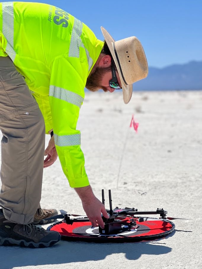
Gamma Ray Spectrometer Testing and Evaluation
Department of Energy Office of Legacy Management (DOE-LM) Calibration Pads at Grand Junction Regional Airport (GJT)
USGS geophysicists at the Geology, Geophysics and Geochemistry Science Center (GGG) are engaged in studies of potential mineral resources from both in situ deposits and mining waste and tailings through the USGS Mineral Resources Program, including the Earth Mapping Resources Initiative (Earth MRI) effort. Airborne radiometric methods were first developed in the 1970s, primarily to assist with uranium exploration. The development of improved sensors and processing technology has led to new applications such as geologic mapping, mineral resource evaluation, and mining waste characterization (Shah et al. 2020; Shah et al. 2021).
Utilizing UAS technologies to conduct gamma ray radiometric surveys can facilitate a 10-fold or more increase in resolution over airplane or helicopter radiometric surveys because of reduced distance between source and sensor. At the same time, the UAS platform can reduce and potentially eliminate the need for personnel to walk, hike, and climb in unsafe terrain and environments where data collection is required.
The Department of Energy Office of Legacy Management (DOE-LM) maintains calibration facilities for environmental radiation sensors at the Grand Junction Regional Airport (GJT) in Grand Junction, Colorado. These facilities include large, flat concrete pads constructed with known concentrations of radioactive potassium, thorium, and/or uranium which emit gamma rays and are a high-quality calibration source utilized by crewed aircraft.
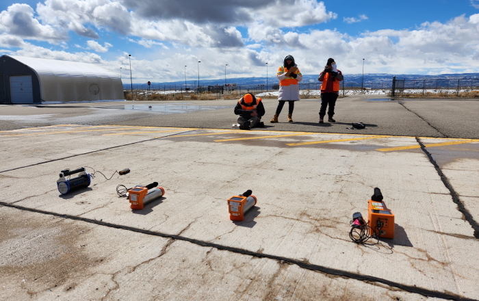
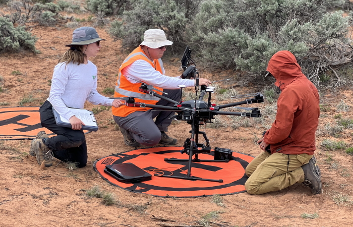
These calibration pads provided a safe, controlled environment for USGS personnel to learn, test, and evaluate handheld gamma ray sensors in addition to a Medusa MS-350 Gamma Ray Spectrometer recently acquired by USGS NUSO. The Medusa M-350 is a next-generation lightweight (< 3 kg) CsI sensor that can be used as part of a UAS. In coordination with DOE-LM and GJT, USGS NUSO flew a variety of transect spacings, altitudes, and directions over the radioelement calibration pads built into the tarmac at GJT. USGS G3SC researchers additionally collected static measurements with handheld gamma ray spectrometer instruments to assess radiation at a variety of heights over the calibration pads to compare instruments and readings.
This project was made possible by extensive communications with the Airport Authority, Tower, FAA personnel, DOE-LM contacts, and aviation safety personnel. This was our first UAS mission ever executed on an active airport.
Learn more:- Earth Mapping Resources Initiative (Earth MRI)
- National News Release: USGS Makes $5 million available from the Bipartisan Infrastructure Law for mine waste research
- National News Release: Scientists Discover Significant Critical Minerals Potential in Northern Maine
- United States Department of Energy Office of Legacy Management (DOE-LM) Calibration Facilities
Study Points of Contact:
Joe Adams, IT Specialist & Remote Pilot
NUSO, Geosciences and Environmental Change Science Center
jdadams@usgs.gov
Anjana K. Shah, Ph.D., Research Geophysicist
USGS Geology, Geophysics and Geochemistry Science Center
ashah@usgs.gov